Click for Dawsonville, Georgia Forecast Click for Damascus, Virginia Forecast Click for Harpers Ferry, West Virginia Forecast Click for Gorham, New Hampshire Forecast Click for Millinocket, Maine Forecast

Wednesday, December 29, 2010

Follow Section Hiking the Appalachian Trail on Twitter


Follow Section Hiking the Appalachian Trail on Twitter!

Often a full blog post is not appropriate for the many short Appalachian Trail articles and discussions we find weekly. The new Twitter account allows us to provide more frequent links to items that section hikers might like to know, such as alerts from the Appalachian Trail Conference (ATC). We also will tweet the availability of new blog articles.

If you are a provider of hiking services and have a Twitter account, please follow @Section_Hiking, as we want to follow you! We hope to follow a growing group of parks, hostels, outfitters and deli's along the entire AT and provide a comprehensive source of information for section hikers.

If anyone knows of a Appalachian Trail resource (lodging, eating, sightseeing, trail angel) on Twitter, please leave a comment to this post.


Tuesday, December 28, 2010

Bear Bagging: Ursack Bear Bag

One of the most important skills for a section hiker to master before setting off on a section hike of the Appalachian Trail is bear bagging. Losing one's food to a bear is very demoralizing and has caused more than one hiker to abandon their hike. In areas like the 100 Mile Wilderness, losing one's food due to improper bear bagging could result in immobilization.

During our past 2-week section hike, we spent an inordinate amount of time (15-min/day = 2.5 hrs = 4-5 miles) selecting a suitable tree and branch to set up our bear bagging system. We used the Pacific Crest Trail or PCT bear bagging system, which uses one rope, a bag, a carabiner and a stake/stick. While standing beneath the selected tree and attempting to swing our rope up and over the desired branch, we often wished for a better solution. We were very excited to receive an Ursack bear bag as a Christmas gift.


Its one thing to watch a video showing a bear attempting to get into an Ursack, but its another to hold one in one's hands and examine it thoroughly. The sack is larger and stiffer than we had imagined. We can easily bag our cook kit and at least five days of food plus even more. Our problem is likely to be trying to stuff a very full Ursack into our small $30 Walmart backpack.

The instruction card mentions crossing the cord, which is rock climbing grade kernmantel rope with about a 5,000 pound breaking strength. Looking inside we saw that the installed cords do cross. We then pulled the bag closed and tied a double overhand knot as instructed. Not only does the bag keep out bears, but there was very little gap for even a mouse to enter. After tying the overhand knot there is plenty of rope to pass around a 5-inch branch or tree trunk and still tie a figure-8 knot as recommended.

This is a well made product and we look forward to trying it out on a scheduled weekend shakedown overnighter this spring. We'll update this post with anything new or interesting we discover.

Tuesday, November 23, 2010

Hiking Trails: Ouachita Trail in Arkansas

In preparation for our 2011 Appalachian Trail section hike in New Jersey and New York, we have started improving our hiking fitness by hiking sections of the Ouachita National Recreation Trail here in Arkansas. The trail is about 223 miles long and runs from just west of Little Rock into Oklahoma.

Our wife is a historical re-enactor and was taking a Dutch oven cooking class, so we tagged along, as the Ouachita Trail begins/ends less than 50 yards from her class. We were surprised at how far we were able to travel in just four hours. We completed all of the Ouachita Trail in the state park and then several more miles. If we hadn't needed to return to the park, we'd have been a third of the way around Lake Maumelle, a large watershed lake adjacent to the state park.

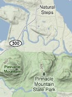
Starting at the Pinnacle Mountain State Park visitor center, the Ouachita begins a steep downhill towards the Big Maumelle River. The water bars in this section are railraod ties with considerable vertical distance. After crossing a park raod and making several turns on the way down, the trail is very flat and follows the river course. Several over-blazed stones identify a turn southwest, which also is flat and crosses under a large powerline and a railroad track. After crossing the tracks, the trail makes a sharp turn south and crosses the road intothe East Summit parking area. We took a quick rest stop at the parking area on some boulders, checked the fit of our boots, gulped some water and loaded our pants pockets with snacks.

From the East Summit parking lot, the Ouachita Trail merges with several park trails and circles north and west around the base of Pinnacle Mountain. The trail exits the state park at the intersection of Highway 300 and the main access road. The trail then follows Highway 300 across several bridges. The old highway bridge has been left for hikers. The steel barricades provide great seating for a quick break and contemplation.

After crossing the last bridge, in a traffic lane, the Ouachita Trail makes a sharp turn west and follows the overflow spillway to the lake. The trail here is flat and meanders a bit at first. We passed behind a church, which caused us to consider asking them to start a weekend evening hostel/camping ministry as there is no legal camping in the area of the trail. After leaving the church, the trail follows the spillway and adjacent Spillway Road. We noted an access point with official signage on Spilway Road just about a quarter mile from the spillway dam itself. Atop the dam there is a concrete butress that provides seating for one with good views of both sides of the spillway. This was our turn around point.

You can find a good description of part of our walk along with several good photos on the Ouachita Hiking Journal. So, we now have less than 220 miles left to complete the Ouachita Trail.

Monday, November 22, 2010

Trail Food: Starkist Tuna Salad

Restocking the office pantry a week ago, we grabbed our usual half dozen pouches of tuna. We like tuna pouches for both office and trail due to their ease of use. Just rip open a pouch, add condiments to taste, and eat! While we have seen the new flavored tuna pouches, we noted a new tuna product from Starkist - tuna salad. We tossed a pouch in our cart for review here on the blog.

Starkist tuna salad is premixed tuna and condiments in one convenient pouch. The ingredients list tuna, water chestnuts, celery, dill relish, white vinegar, sugar, salt, onion powder and egg yolks. With the exception of the water chestnuts and vinegar, the ingredient list reads much like the tuna salad our mother made for us many years ago.

We ate our tuna salad much like we would on the trail. We started with some hot pork ramen soup, which we always have with trail dinners. We then ripped open our pouch of tuna salad and dug in. Crunchy. Definitely crunchy. We could taste the celery and the bitter bite of the vinegar. As we hadn't yet read the ingredients, we assumed the crunch was celery, of which we are not fond. It was only when we paused to examine a fork full of tuna salad we discovered the pearly chunks of water chestnuts and relatively little celery. We decided today at lunch that we are not a fan of water chestnuts in our tuna salad. In fact, we decided that we would rather stick with packing pouches of plain tuna in water or oil and then seasoning the enclosed tuna with mayonnaise and pepper to our own taste. Sorry, Charlie. We like you just as you are/were.

As we know that individual tastes differ, Starkist tuna salad maybe just what you want in a trail food. We can see the advantage of one piece of trash to pack out versus multiple condiment packets. As the cost of Starkist's tuna salad is about a dollar, we recommend you buy a pouch on your next grocery run and give it a taste.

Disclosure: We select and purchase the product(s) reviewed. We have no material connection to either the manufacturer nor the retailer(s).

Monday, November 15, 2010

Section Hike: Delaware Water Gap, PA to Graymoor, NY

My 2010 section hike went so well that I'd like to continue north along the Appalachian Trail. Although I stopped at Carlisle, PA, the remaining distance in PA is more than I can likely hike in two weeks. So, I've planned to start at Delaware Water Gap (DWG) and hike to Graymoor in mid New York. This distance seems easy to make and provides nearby transportation to and from the Appalachian Trail. Ending at Graymoor also sets me up to continue sectioning from Graymoor, completing New York and Connecticut, and ending near public transportation in southwestern Massachusetts.

The basic plan is to Greyhound to New York City, switch to a Poconos casino bus, remain overnight at the Presbyterian Church of the Mountain hostel, hike north, resupply in Unionville, hike north some more, clean up at Graymoor, ride the train back to New York City and Greyhound back to Arkansas.

Based on our 2010 experience we alternated long and short days to average about 11 miles per day for the two weeks. Day one is ten miles from DWG to the Mohican Outdoor Center. Day two is shorter with an early stop at the YMCA camp. Then two nights at shelter areas and an anticipated bear encounter. We plan to use an Ursack instead of a traditional bear bag. We also might experiment with a mail drop of dehydrated goodies like chili, chipotle black beans, tuna packets, and pork ramen at Highpoint State Park.

We read this morning that a Major Brooks in the Marine Corps Reserve Force Recon is planning to thru-hike the AT next spring to raise funds for wounded veterans via the Semper Fi Fund. His online schedule puts him in the same section during mid-May. We'll try to adjust our schedule to position ourselve slightly ahead of his arrival as his schedule has him making tremendous distance each day and finishing the AT in early summer.

Monday, August 30, 2010

Camp Fuel: Harpers Ferry

We note considerable interest by visitors wanting information on obtaining camp fuel along the Appalachian Trail. So, we start a series of posts on camp fuel availability with information on obtaining fuel at Harpers Ferry.

Alcohol Fuel

As we used a SuperCat alcohol stove for our section hike from Harpers Ferry, we located several sources for alcohol camp fuel. One source is the Appalachian Trail Conference (ATC) office in Harpers Ferry itself. Alcohol fuel is stored outside on the front porch in a box. Fuel is by "donation". Denatured alcohol is $6/quart from the Walmart in Martinsburg some distance away, so be fair, if not generous.

Alcohol fuel for your camp stove is also available from the Outfitter at Harpers Ferry. Just go inside and up the stairs to the register and ask for fuel. You provide the container. Fuel is $.50 per ounce and we had several ounces of leftover fuel at Boiling Springs from our 20 ounce pop bottle. The only problem with using the Outfitter for camp fuel is they are usually closed by the time you arrive in Harpers Ferry by train.

Alcohol fuel is sometimes available at the hostel located about 2 miles north of Harpers Ferry. The hostel is just off the Appalachian Trail making a quick stop for NOBOs a possibility. Call ahead to confirm alcohol fuel is available.

Butane Fuel

Butane fuel cartridges are available from the Outfitter at Harpers Ferry. Several varieties were available the day we stopped.

Butane fuel cartridges are also available at Walmart in Martinsburg, as are small lightweight, folding butane stoves.

Propane Fuel

We can't imagine anyone carrying a steel bottle of propane up the trail, but if you need propane camp fuel, you'll find some at the KOA store just outside Harpers Ferry. Propane is also available at Walmart in Martinsburg.

Thursday, August 12, 2010

Appalachian Trail MD: PennMar Park


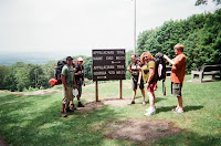
The last sightseeing stop in Maryland along the Appalachian Trail is PennMar Park. PennMar is a popular starting point for those wanting to do a short 3-4 day section of the Appalachian Trail. Numerous regional Boy Scout troops and patrols use the PennMar to Harpers Ferry section of the AT for the basis of their 50-mile hiking badge program. Our section hike over the Memorial Day weekend proved the norm. We met three southbound scout groups in less than 24 hours of the weekend beginning and several smaller groups of three somes and five some starting south from PennMar.

PennMar has an interesting history as a recreation center for the Baltimore and Washington region for over a hundred years. Gone are the old hotels, ice cream parlors, dance floors and other favorite pursuits of yesteryear. Today stands a large city park looking above and towards Pennsylvania.

North bound hikers will arrive at PennMar after first descending from High Rock down a boulder field. The trail opens wider into a worn gravel road. One starts to see homes and hear vehicles off to their left. Minutes later one hears children and sees playgrounds on the right through the trees. At the end of the gravel road, the trail makes a sharp right and you are in PennMar Park proper. There's a large pavilion ahead with some picnic tables between it and the turn into the park. If you can resist the urge to stop at this first set of tables, wander a bit further around to the other side of the pavilion.

On the opposite side of the first pavilion one finds the smaller famous pavilion which overlooks Pennsylvania. Just further and up a slight rise one finds the restrooms and water. Here's a secret that many AT hikers never discover when passing through. The first sink in the men's room has a large goose neck spigot for filing water bottles and hydration bladders. (Guys, offer to fill the ladies water containers!)

If you've read my TrailJournals.com log entries, you'll know that I had been unsuccessful trying to get a cold soda at every opportunity in Maryland. Fortune smiles upon hikers at PennMar. There are two working soda machines just south of the restrooms and pavilions. Just look up the rise to that other brick building and you'll spot the machines on the north trail-side end. We bought two. One for lunch and one that we stuffed inside our foam pad for later up the trail. (Our foam pad road flat atop our pack. Shove the bottle in and then stuff the ends with your pack cover and a spare trash bag.)

From PennMar the trail continues north behind the restrooms by the pavilions. You start descending a gravel road bed with telephone poles along the right side. You are hiking down the old trolley car line. At the bottom of the gravel road, you'll make left turn, cross a paved road, and then cross some railroad tracks. Someone has removed the famed Mason Dixon Line sign, so remember the train tracks are the roughly boundary. Cross the tracks and you're in Pennsylvania.

The trail will continue down a bit to a beautiful wooden footbridge and then begin a steep climb back up. There are two boxed spring along the road crossing about halfway up the hill. Bailey Spring is the next water hole after the boxed springs, then a series of double shelters built along springs.

On our section hike, we got a late start (9 a.m.) off raven Rock and then dawdled too long at PennMar and thus made it only to deer Lick Shelters that evening. Get moving sooner and try to get up the trail to either Antietam or, even better, Tumbling Run Shelters. Tenting is also better at Antietam and Tumbling Run shelters.

Wednesday, August 11, 2010

Appalachian Trail MD: I-70 Footbridge

While not as popular as the Washington Monument, the I-70 footbridge is nonetheless one of the more photographed sights along the Appalachian Trail in Maryland. However, finding the trail to footbridge for north bound hikers is somewhat confusing, as is finding the trail north on the other side of the foot bridge.

North bounders (NOBOs) will exit the woods at a residential road with two houses across the street. The day we hiked this section of the trail, an older gentleman on a riding lawnmower was riding back and forth cutting the lawns of both homes. We were a bit befuddled as, surely the trail wouldn't pass through someone's yard. The Appalachian Trail is a national foot trail after all. We looked both directions on the road and nary a white blaze was to be found. No blazes were on trees nor on the pavement. Hmm... Let's back up and check that last blaze. Perhaps we missed the turn signal. Nope. Single white blaze - the trail continues straight. Finally, peering across the road we spotted the white blaze on a large tree between the two houses.

The Appalachian Trail does indeed pass between two homes in Maryland. There are two low rock gradens with plants and the trail is a well worn path down the middle of the garden beds. Passing a home, a rail fence appears on your left and then the trail seems to end at an overgrown chain link fence. The freeway lies beyond.

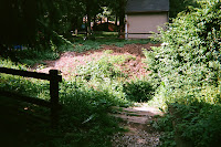
Looking down to our left we found brown wooden railroad ties fashioned into steps leading down. Gingerly, we stepped down and at the bottom found ourselves looking through the chain link tunnel that is the I-70 foot bridge.

Not being a thru-hiker, we hadn't yet experience crossing some of the earlier freeways further south, so this was a new experience. Walking across the foot bridge we recalled our travels with our young family when we drove our little Ford Escort station wagon underneath this very bridge and noting the green sign proclaiming "Appalachian Trail." Someday we thought - someday. Someday was today!

Standing astride the north/west bound lanes we fished out our camera and took a quick photo for posterity. As we turned to leave, a car sounded its horn to signal both approval and encouragement. We realized that they probably thought we were a thru-hiker and felt that the "toot" was not fully deserved. However, for a first time long distance hiker still struggling on the third day, the sound was encouraging. Especially since we had just decided earlier to end our day not at the shelter on the other side of I-70, but several miles further at Annapolis Rock, MD.

Coming off the bridge we noted the well worn trail leading up the hill through the overgrown brush. Following the well worn path we arrived at an old section of asphalt road and noted the trail seemed to turn right and then crossed over a dirt hump. We dutifully turned and headed up and over the hump into a parking area. Moments later we realized that we had once again lost the trail. How was that possible?

When exiting the foot bridge north, we were so enamored with the traffic below that we missed the double blazes indicating a right turn and descent down below the footbridge. The Appalachian Trail actually parallels I-70 for about a quarter of a mile, passing underneath the next bridge to the west and then turning right and up a steep incline. We doubled back, found the trail along the fence, and continued west and then up. (The AT is actually visible in the photo, between the lower green sign and thing fence line to its left.)

So, for NOBOs, remember: Go between the two houses, down the wooden steps, across the bridge, right turn down the embankment, and west to the next bridge. SOBOs seem to have no confusing turns in this section of the MD trail.

Tuesday, August 10, 2010

Appalachian Trail Map: Blog Visitor States

We were looking through our site analytics and noted this map depicting visitor locations clearly shows the rough course of the Appalachian Trail.

The largest concentrations of visitors to the Section Hiking the Appalachian Trail. blog hail from Georgia, Virginia, Pennsylvania, and New York. Judging from the map, we need to section hike around the Smokey Mountains National Park to attract visitors from TN and NC. Also, a section hike in New England would also enable us to write articles of interest to hikers and backpackers in Maine, Vermont, and New Hampshire.

Just thought you might like a peek under the hood here at Section Hiking the Appalachian Trail. We do analyze visitors and topics of interest and try our best to provide you the reader with the information you are seeking.

Monday, August 9, 2010

Appalachian Trail Maryland: Washington Monument

One of the most popular and memorable sights along Appalachian Trail in Maryland is the Washington Monument. You don't have to worry about missing it, as the Appalachian Trail goes right up to it, if you're following the white blazes.

Northbound Appalachian Trail hikers will reach a road crossing with Washington Monument State Park across the road. Follow the gravel path on the opposite side up towards your right. You'll first find a bulletin board with a map of the park and the usual rules for hiking the trail in Maryland. Continue on up the trail as it goes uphill and across a grassy open area.

You'll make a left turn on the main park entrance road and continue uphill past building on your left to a parking area with a low gray stone wall. Resist the urge to doff your pack and sit on the wall. Those fir trees will embed tiny pricklies in your shirt and backpack pad. Instead, take a few more steps up the short stairs and take a break at the small pavilion just on the left side of the now gravel trail. The water spigot is just across the trail from the pavilion.

If you need restroom facilities, then go back down the steps and turn right. Follow the sidewalk past the museum and you'll find the restrooms in a brick building just down the hill.

Once you've topped off your water, then continue on up hill on the gravel path from the pavilion. The trail will wind up and towards your left as you ascend. At the top, the Washington Monument will be directly in front of you. Glance to your right as you enter the clearing and you'll see the white blazes indicating the trail continuing north.

The monument has a spiral iron staircase inside that you can climb to the wonderful view from the top. You can drop your pack just below the monument where you'll find a small rock bench and a rock walled area. If you arrive before noon, then there's probably shade.

When you're ready to leave the area, then head back to the side of the clearing you entered, but steer left onto the northbound trail. The trail north from the monument is steep downhill with large railroad tie water bars. Southbound hikers should follow the gray gravel trail back down to the pavilion and top off water for the hike south to Rocky Run where a piped spring awaits.

Also, if you're northbound out of Washington Monument SP, then you should consider stopping for the night at Annapolis Rock. Yes, there is camping and a piped spring to be found there as well as a magical sunset dinner.

Thursday, August 5, 2010

Appalachian Trail Maryland: Gathland State Park

Hiking north on the Appalachian Trail from Harpers Ferry, the first Maryland state park one encounters is Gathland State Park.

Gathland SP is memorable due to the unusual looking War Correspondents Memorial which is easily visible from along the trail.

North bound hikers will be descending as they enter Gathland SP. You'll see an opening to your left with steps going down towards a clearing. As you exit the woods and enter the park proper, you'll see a building and a large tree with wrap around benches. Head for the bench and take a load off your back.

Unless you made the 4/10ths mile trek downhill and back at the Ed Garvey shelter, you're probably thirsty and looking for water. Pure water is available from the red faucet located between the tree bench and the restrooms. If you're looking for a cold soda, you're likely out of luck, unless offered trail magic. There were two soda machines at the end of the restrooms facing the tree bench, but neither worked and both were scheduled to be removed at the end of May 2010.

Refreshed and re-hydrated, this is a good time to wander along the rock wall and read the various plaques detailing the civil war history of this area. Remember, you'll not likely pass this way again unless you're a local hiker. Don't forget to get out your camera and take a photo of the War Correspondents Memorial.

If this is a planned meal stop, then after getting water, head across the road where you'll find a pavilion with picnic tables.

For everyone continuing northbound along the Maryland section of the Appalachian Trail, the trail continues north from the intersection in front of the memorial, up the grassy hill to the right of the picnic pavilion. Shortly after re-entering the woods at the top of the hill, watch for the blue blaze trail on your right to Crampton Gap shelter.

Monday, August 2, 2010

Appalachian Trail Maryland: Annapolis Rock

Annapolis Rock was my favorite stop along the Appalachian Trail in Maryland. I am incredibly indebted to the two PATC Trail Patrol members that recommended to Redwing, Lil Dipper and myself to spend the night at Annapolis Rock. Mind you that I had just visited Maryland's Washington Monument State Park earlier in the day. The Washington Monument section of the Appalachian Trail is well maintained and the view of Boonesboro, Maryland from the top of the monument is not to be missed. But, Annapolis Rock is a definite must stay.

Getting to Annapolis Rock

NOBOs will first make a moderately steep climb up from I-70. After leveling out, watch for the blue blaze trail on your left. If you reach the Pogo camp site, you've overshot quite a bit.

Day hikers should head north on the Appalachian Trail from South Mountain State Park. There's a parking area on US Highway 40 (Baltimore National Pike) just north of the I-70 footbridge. From the south end of the parking area, walk over the hump towards the sound of the freeway. Continue down the paved section to the footbridge. You'll see a trail on your left. Don't cross the footbridge, but continue down the left side of the footbridge, hike along the I-70 fence line, and back up just past the next overpass (US 40). Follow the white blazes of the Appalachian Trail about 2.2 miles to the blue blaze trail to Annapolis Rock.

SOBOs should watch for the blue blaze trail on their right about a mile after the Pogo camp site. The trail from Pogo is relatively flat and mostly dirt. You'll be able to make up some of the time you lost coming through the 3 miles of rocks.

Camping

First, there's considerable camping available at Annapolis Rock. The guidebooks all make clear that while hiking the Maryland section of the Appalachian Trail, one must stay at shelters or in the immediate area around a shelter. Like many newbies, I wasn't aware that camping at Annapolis Rock was an option. Coming down the trail, one first sees a large bulletin board with a map of the Annapolis Rock area and the various camping areas. Even with a third of the tent camping areas closed for reforestation, we had a selection of many very nice camping areas.

Taking an immediate left at the sign, we wandered through dense mountain laurel and examined site after site looking for the ideal spot. About halfway down on the left, we found a nice clear area with an ideal set of trees and a convenient log.

Amenities

Second, Annapolis Rock offers nice amenities for its type of location. Sure, there's the showers at Dahlgren Camp that the kind folks of Maryland offer as a gift to hikers and the clean restrooms and machines with cold sodas at PennMar park. But, considering this is a primitive camp site by national park service standards, Annapolis Rock features two privies and a piped spring. The piped spring was gushing so much water that it looked like a broken water main. (I'm still not convinced that much water can come from the a spring at the top of a hill for as long as it did and not be man made.)

Dinner and a Sunset

Third, the actual Annapolis Rock formation and its vista is truly worth the extra effort to hike down the blue blaze. The PATC Trail Patrol mentioned we should first make camp and then take our mess gear down to the rocks for dinner and a sunset. Annapolis Rock accomodates a lot of backpackers with room for all to enjoy the sunset. Rather than another meal at another generic wood picnic table, we had the fun challenge of selecting a dinner spot and the reward of "dinner and a show."

So, whether North bound or South bound along the Appalachian Trail in Maryland, give serious consideration to remaining overnight at Annapolis Rock. Get there well before sunset, select a campsite, and head on down to Annapolis Rock for a memorable sunset with your fellow hikers.

Thursday, July 29, 2010

Appalachian Trail: Knives

Knives are a big concern among many hikers planning to hike the Appalachian Trail. Concerns range from what kind of knife to carry to the legality of carrying knives along the Appalachian Trail.

What knives are being carried?

In 2010, hikers along the Appalachian Trail were carrying everything knife-like -- from large, heavy machetes to small, ultralight, single-edge razor blades. During our recent section hike, we noted a significant number of swiss army style knives and folding buck style knives.

In our own preparation, we bought a cheap $1 folding buck style pocket knife and a small, fisherman's multi-tool for $5 at Walmart. Post-hike, it's clear that we should have left the folding knife at home. The blade on our multi-tool was more than sufficient for nearly everything we had to cut. The only exception was cutting some original moleskin. Neither the scissors nor the blade on our multi-tool was able to trim off a piece of moleskin. The folding knife allowed us to hack off a piece. God bless "Scissors" for having her dad's old swiss army knife at Quarry Gap shelter. Her scissors cut the moleskin just fine.

Our recommendation is to go with the smallest, sharpest knife that you can get by with. Your pack is going to weigh more than you would like, so cut some weight here. Many ultralight backpackers carry only a single edge razor blade. We may downsize to a razor blade for future hikes ourselves, provided we can get our hands on a set of lightweight keychain screwdrivers for tightening our hiking pole clamps.

TIP: Test your knife or substitute many times before departing for the trail.

Thursday, July 22, 2010

Greyhound Bus: Lynchburg VA

We arrived at the Greyhound bus station in Lynchburg VA around 8 a.m. on a Monday morning. The northbound bus from Knoxville, TN stops in Roanoke before continuing on to Lynchburg. The bus follows a very scenic route through a pass in the Blue Ridge Mountains. Coming in to Lynchburg from the south, the bus passes Liberty University and then the modern commercial area of Lynchburg with all the chain stores. The bus continues north and then exits the expressway, circles right and over, and continues up a large hill into the older historic Lynchburg. The bus then pulls onto a cobbled street and up to the train station.

The Lynchburg-Kemper Street Station is a multi-storied building set on the side of the hill with the parking and bus area above and the tracks below. Our bus took about a 20 minute break, just enough time to get fresh water, dump some water, and check out the station.

Entering the door finds ones self in a small, but nice lobby. The ticket counter is to your left and the restrooms are towards the right. There is no restaurant and we don't recall there being much food or drink available. We noted no stores or food services along either the immediate arrival or departure routes. Recommend you bring some food or snacks with you if Lynchburg is your final destination.

There seems to be a local bus that circulates near the station that also serves the Liberty University area and the big box stores area.

Backpack Cover for Flying

Several past visitors arrived looking for information on backpack covers for flying. While I haven't flown with my backpack, I have ridden several buses with a backpack.

On an earlier shakedown hike in California's Big Sur, I used a large lightweight nylon duffel to over-pack my 5500 cu.in. backpack. I bought my nylon duffel at Academy Sports for about $15. The dark green Timber Creek duffel we bought has a large piece of webbing sewn around the duffel to create two large hand straps. Actually, the straps are so large one could almost wear the duffel as a pack itself. We used a small carabiner to clip the two straps together to make picking up much quicker and easier.

Once at our destination, we folded the duffel into a packet and placed it on top of the closed main compartment, flipped the top pocket back over, and fastened the retaining straps. When we returned to the Greyhound station at Salinas, we opened our pack, expanded the duffel, dropped our pack inside, and attached the new baggage tag.

While we've not done this on the trail, we did experiment at home and discover that we could turn the duffel inside out, which positions the handles inside and prevents them from snagging on branches along the trail. The duffel doesn't quite unzip the entire length, so there's a small "hood" that one can place over the top of one's backpack and the duffel will naturally hang over the pack. Its an easy task to take a spare nylon strap, like the ones used for attaching sleeping bags and pads to exteriors, and wrap it around the pack and duffel. As our duffel is longer then our pack, we found we could under-fold the excess material so the top of the duffel material overlaps the bottom and secure the entire fold with the nylon strap.

Hope this is helpful to those of you flying to the Appalachian Trail.

Wednesday, July 21, 2010

Greyhound Bus: Charlottesville VA

We arrived at the Greyhound bus station in Charlottesville, VA on a Greyhound bus arriving from Lynchburg and Roanoke, two towns further south and near the Appalachian Trail. The bus crosses north beneath I-64 and continues straight into town. Our bus arrived about mid-morning.

The Greyhound station in Charlottesville VA is an older building. There is no restaurant, but there are vending machines for soft drinks, salty snacks, and cold sandwiches. The restrooms were fair, which puts them at the upper end for Greyhound. The ticket counter is at the right-hand end when entering from buses.

Stepping out the main entrance we spotted an international food store just across the street and down to our left. As our bus had arrived late and we expected our interconnecting bus to arrive at any moment, we did not explore the store.

We did inquire of the ticket counter about shuttles to Rockfish Gap. They informed us that no such services exist. It seems these Greyhound employees are unaware of the underground transportation system that exists among Appalachian Trail hikers. As its about twenty miles to Rockfish Gap, recommend arranging a shuttle from one of the many people recommended by ATC or on Whiteblaze.com

Tuesday, July 20, 2010

Appalachian Trail Pennsylvania: Henicles Market


During our 2010 section hike along the Appalachian Trail in Pennsylvania, we resupplied at Hennicle's Market in Fayetteville, PA. Henicle's is located less than a mile off the Appalachian Trail, just down the street from Caledonia State Park. We first showered and cleaned up a bit at Caledionia S.P so as to not render undue suffering on customers. Showers are just $3 at Caledonia State Park.

Arriving at Hennicle's Market, we dropped our packs outside by the two grocery carts. The door in the middle is the entrance and the door to the left, which I first entered, is actually the exit. Locals will be entering through the middle and circulating counter-clockwise. Best you go with the flow also.

Henicle's is a small compact store with a bit of everything. After entering and turning right, the first area has disposable cameras and some limited hardware.

Moving up the same aisle you'll find fresh fruit and vegetables to your right. Henicle's had small tubs of sliced melon for just sixty cents the day we were there. We also found oranges priced at three for a dollar. Bananas were available and reasonably priced.

At the back of the aisles and store, you'll find the deli and meat case. Henicle's offers a number of sandwiches and sides. The day of our visit found a quarter roasted chicken (leg and thigh) priced for less than two dollars. We also found some hard salami in the meat case and bought a half pound for our trek. We kept the salami cool in our Bubblelope freezer bag cozy.

The middle two aisles contain most of the groceries. Propel is available in three flavors; we bought lemon. Tuna is also available, but most was in cans. There were also packets of tuna, but those available were family sized and priced at about three dollars. We bought a can of tuna to be consumed within the first 24 hours. Ramen is available in flavors of beef, chicken, and shrimp. We dearly love pork, but bought several packs of beef ramen. We found instant potatoes in the middle of the aisle and only two packets were still available. We bought one packet and left the other for hopefully another hiker.

We looked for beef sticks, as in the larger, meatier ones that can be sliced and added to potatoes and soups. The best we found were some small cans with small and very dry bits of beef. Some jerky was available nearby. We recall the dried meats being on the end of an aisle.

The last aisle which aligns with the exit door has frozen foods and dairy products. We found several local brands of orange juice and tea very reasonably priced and bought a pint of each.

Checkout was very friendly and fast. We spent about $22 to resupply for five more days on the trail plus a very nice Memorial Day feast to share with a thru-hiker.

Outside Henicle's Market you'll find a pay phone, just in case you wish to reach out and touch somebody while waiting for a lift. We didn't wait very long before a local with a pick-up truck offered us a ride back to Caledonia S.P.. Kudos to trail angel Paul.

If you're planning thru-hike or a longer section hike, consider adding Henicle's Market as a resupply point. If anything, stop by Henicle's and grab something luxurious to add to make your time at the famed Quarry Gap shelter more special. You'll be glad you did!

Henicles Caledonia
7798 Lincoln Way East
Fayetteville, PA 17222
717-352-2487
http://heniclesonline.com

Henicle's Market accepts Visa, Mastercard, EBT/SNAP, Discover and American Express Cards

Store Hours:
Monday through Thursday 8 am - 8 pm
Friday & Saturday 8 am - 9 pm
Sundays 9 am - 8 pm

Tuesday, July 13, 2010

Greyhound Bus: Harpers Ferry WV

First, there is no Greyhound bus service to Harpers Ferry, WV.

However, there is Greyhound bus service near Harper's Ferry WV.

How to Get to Harpers Ferry by Greyhound

Greyhound serves three relatively nearby cities. Greyhound currently serves Hagerstown MD, Fredrick MD and Washington DC. Of these three, it is far easier to get from the Greyhound stations in Washington DC to Harpers Ferry WV. Here's how we did just that for our 2010 section hike from Harper's Ferry WV to Harrrisburg PA.

Arriving at Union Station

Being in the southwest, Greyhound routed us to Washington DC via Roanoke, Lynchburg, and Charlottsville VA. (We'll add posts on their bus stations shortly). This bus stops at Union Station minutes before stopping at the Greyhound station up the street. The Greyhound bus we were on came in behind the U.S. Capitol and entered on the right (north) side of Union Station. The bus goes up a ramp in the rear of Union Station to the second floor deck level. This is were most buses including tour buses arrive and depart from.

After claiming your bags, you proceed east towards the building and the ramp. Follow the crowds down the escalator into Union Station proper. At the bottom of the escalator, you should see McDonalds ($1 value menu offered) to your far left at the north end of the departure area. The MARC departures are at gates one through four (1-4) to your far right and just before the liquor store and the men's room. You likely need to purchase a MARC ticket for the train to Harper's Ferry, so just continue straight ahead and then turn to your right where the ticket counters start. A ticket to Harper's Ferry is currently $11 one-way on the MARC. The Harper's Ferry MARC is an express which skips about a half dozen early stops.

As you're likely early, you might like to back track and locate the exact location of the MARC gates. There is a MARC waiting area just to the right of the gates with a departure video display.

If there's still time and you're hungry, just walk past the liquor store and hang a left. There a series of cafes along the west end of Union Station. Prices are largely the same from eatery to eatery. If you'd like some fresh fruit or bread, just continue south past the bookstore and outside. There are about a dozens stalls on the west porch that offer water, fruit, bread, flowers, and other commuter favorites. This is also the smoking area if you venture much further.

Boarding the Train

Closer to boarding time, head on back to the waiting area. Note that commuters line up just outside the MARC gates and then rush the trains as they open for boarding. Don't feel compelled to join the stampede as there are plenty of seats. Many of these early arrivals are regulars and are competing for seats on the upper deck.

When your train begins boarding follow behind the crowd. We jumped in the first door we found open. You might take a moment and confirm with a commuter that you are in fact on the train to Harper's Ferry. Find a seat on the lower level and get comfortable. (We sat on the left hand river side and it didn't seem to matter. There wasn't much to see on this leg.) Slide your ticket into the metal clip on the top of the seat in front of you. The conductor will be by around departure or just after to check your ticket. Don't be surprised to see a police officer at the far end near the stairs. Its post 9/11 after all. No one searched our pack, but we were given an eyeballing a few times.

Arriving at Harpers Ferry

The train arrives at the foot of Union Street and much of Harper's Ferry business district will be closed.

Lodging & Camping

There are two bed and breakfast inns across the street from the ATC office and the post office is just a few blocks past them on the same side of the street.

If you'd like to stay at the Comfort Inn, then just follow the AT south to the Shenandoah River bridge. The AT heads south at the bottom of Union Street and goes up stone steps past the Catholic Church. Jefferson Rock is along this short section of the AT. Comfort Inn will be just to your right at the bridge. Hikers give the Comfort Inn mixed reviews, so caveat emptor.

If you want somewhere free to stay, then just head back to the train bridge you just rode across and walk back into Maryland. Hang a left on the C&O canal and walk two miles upstream (left) to the Huckleberry Hike & Bike camp. We had it to ourself mid-week. There are several tent areas, a picnic table and a BBQ grill. We found several good trees to hang our hammock from which gave us a nicely framed view of the Potomac River.

Friday, July 9, 2010

Appalachian Trail Videos: Maryland Section Hike Part 2

Finished uploading the second set of photos from our Memorial Day section hike of Maryland and southern Pennsylvania. Here's the second video which covers from Annapolis Rocks, MD to Caledonia State Park, PA.

Tuesday, June 29, 2010

Section Hike: Harpers Ferry to Harrisburg

While not what was planned, here's the section hike schedule we actually hiked along the Appalachian Trail from Harpers Ferry, WV to Harrisburg, PA.

May 24, Mon - Harper's Ferry

May 25, Tue - Ed Garvey Shelter

May 26, Wed - Rocky Run Shelter

May 27, Thu - Annapolis Rocks

May 28, Fri - Raven Rock

May 29, Sat - Deer Lick Shelters

May 30, Sun - Rocky Mountain Shelters

May 31, Mon - Milesburn Cabin

Jun 01, Tue - Pine Grove Furnace State Park

Jun 02, Wed - Whiskey Spring

Jun 03, Thu - U.S. 11 Footbridge

You can find full details for each day of the 10-day section hike in my TrailJournal.

What would I have done different?

First, I should have planned for a shorter first day and anticipated staying at Ed Garvey Shelter. You really do want to stay at this historic monument and see the photos on the second floor.

Second, I should have done better research and stayed at the posher new Rocky Run shelter. I missed an opportunity to meet new trail friends. Remember, take the right hand (northern) blue blaze trail.

Third, I shouldn't have dawdled as long as I did at Raven Rock and PennMar park. I left Raven Rock after 9 a.m.. I stayed at Penn Mar about two hours. I should left earlier from both places and used the extra time gained to press on beyond Deer Lick to either Antietam or Tumbling Run shelters. Tumbling Run is much nicer than Antietam and worth the extra mile or so of easy trail. The extra miles from bypassing Deer Lick would have enabled me to resupply a day earlier and enjoy Quarry Gap shelter as I had originally planned.

Fourth, I really should have held at Boiling Springs as planned. Boiling Springs is a trail town to be enjoyed and savored.

Fifth, rather than stopping short at Highway 11 near Carlisle PA, I should have executed my original plan to catch the bus there and then take the bus north to Clarks Ferry. This would have emabled me to knock out an extra 30 miles in just two more days and over a weekend. Now I still have to section from Duncannon to Delaware Water Gap plus do the 30 miles between Duncannon and Carlisle PA.

Tuesday, June 22, 2010

Trail Journals: Slowly Updating Section Hike Details

Posting at Section Hiking the Appalachian Trail will continue to be light for a few more weeks as we get caught up at home, office and online. We are making an effort to update at least one page in our TrailJounals.com account each evening before heading home. We're just shy of the PA border in our trail journal. If you've previously read our trail journal, you might like to go back and get the details for that day.

We've got another roll of film to upload to the photo album. Then, we'll make a second short Youtube video with the second set of photos. Hopefully you enjoyed the first video in our previous post.

We also plan to go back through our gear list on TrailJournals and update our comments on some of the gear shown.

Then we plan to start adding more information for section hikers based on our experience along the AT in Maryland and Pennsylvania. We plan to cover some of the parks along the way, more details on Henicle's Market near Caledonia State Park, and experiences with shelters and water sources. So we should have plenty to keep ourselves busy until the new year. Then, it will be time to start planning for the next section hike and sharing what we learn during the planning phase.

Saturday, June 19, 2010

Greyhound Bus: Appalachian Trail Stops

Here's the list of Greyhounds bus stops near the Appalachian Trail as of June 2010. We've stopped at all the Virginia bus stations and will link those cities to our upcoming reviews.

Atlanta, GA

Gainesville, GA

Knoxville, TN

Bristol, VA

Roanoke, VA

Lynchburg, VA

Charlottsville, VA

Washington, DC [details]

Frederick, MD

Harrisburg, PA

Delaware Water Gap, PA

West Point, NY

New York City, NY

Bangor, ME

Tuesday, June 15, 2010

Section Hike: Harpers Ferry to Washington Monument

Below is a video from my recent section hike of the Appalachian Trail. This video covers the section from Harpers Ferry to just north of Washington Monument.


This is a very good section for hiking as there are several good vistas and interesting stops along the way. Recommend hiking south from either PennMar or Washington Monument as the trail is then mostly downhill. (There's a reason why Boy Scouts hike this section southbound!)

Friday, May 14, 2010

Appalachian Trail Videos: The Spirit of the Appalachian Trail

Just finished watching this 30-minute video on hiking the Appalachian Trail.


It seems every Appalachian Trail video touches something deep within the human psyche. Many folks after watching an Appalachian Trail video have the sense of "Me too! I want to hike the Appalachian Trail!"

Every spring over 1,000 people attempt a full thru hike, yet only 20% succeed. The class of 2010, as they're known, is no exception. Several hikers have already became discouraged and left the trail. Some leave for psychological reasons, while others leave for medical reasons, usually an injured knee or leg. Those out due to injury will likely one day return and continue their journey. If not this year, then perhaps as section hikers they'll one day attain their goal.

Thursday, May 13, 2010

Trail Journals: Following BigHodag Online

We're close enough to our hike that we opened an account at TrailJournals.com. This is a well thought out journal service for both through hikers and section hikers needing a trail journal. A trail journal account includes a journal, gear list, photo album, a video album and a guest book. TrailJournals.com is not free, but is donation financed. The suggested donation of $25 is a fair price for the value.

We've largely finished our TrailJournals gear list and have uploaded pictures of all our major gear, save a vintage aluminum pot. One of the less obvious steps in loading gear is picture first, text second. One you save your gear details there is no way to add a photo except delete and re-enter. Also, you don't need photos of your actual gear as chances are someone else is using the same gear and has already uploaded the photo. Its fascinating scrolling down a list of hundreds of stoves, followed by hundreds of cups.

We have also added three pre-hike trail journal entries. There's a short list of requirements to have one's trail journal "go public". Three journal entries is required to trigger appearing in the hiker listings.

We plan to ask a family member to transcribe our TrailPhone audio trail journal entries to our written trail journal. The section we are hiking doesn't include many opportunities for a section hiker to lollygag and update a trail journal. We also are not taking a smartphone or other technology for journaling from camp.

As we are taking disposable cameras for our section hike, photos of our section hike will not be available until after we are back home and the film developed and transferred to CD-ROM.

We have also setup a personal YouTube channel. We plan to take our photos and create the obligatory slide show video showing the same highlights from our section hike as everyone else - Weaverton Cliffs, Annapolis Rocks, Correspondents Memorial, etc. Chevy Chase driving in circles in London comes to mind: "Look everyone, Washington Monument!"

By the way, once this post cycles off the homepage, you'll still be able to find mine and other interesting hiker journals in the bottom of the green trail section on the right side. Oh, look! There they are now.

Tuesday, May 11, 2010

Backpacking Food Ideas: Instant Mashed Potatoes

We were at Big Lots the other day and saw some packs of Hungry Jack Cheesy Homestyle Easy Mash'd Potatoes for just sixty cents. While instant mashed potatoes is not a new backpacking food idea, cheesy flavored mashed potatoes is a newer backpacking food idea.

We recall back in the 1970's when we started backpacking that only unflavored potato flakes were available. We would fortify our spuds with texturized vegetable protein powder and powdered milk and add a crumbled bullion cube or powder to the mix for "gravy". Just add water! Revolutionary at the time. Problem was, after instant potatoes twice daily for a 3-day weekend trip, one was "mashed out." We were so mashed out we didn't even backpack instant potatoes for several decades following.

So we bought a bag to try at lunch.

As we are close to our upcoming section hike, we lunched as we would on the trail. We grabbed the mess kit, potatoes, water bottle, and a pint-sized plastic cup. The details on the spuds said to add to two cups of hot water. We poured a pint (2 cups) of water into our pint cup and microwaved it. (Didn't think the boss would appreciate letting our super cat stove blaze away in the break room.) While the water was heating to a near boil, we transferred the spuds into a freezer bag and mixed. Its looks like the cheese and potatoes are added separately at the processor as there was segregated white stuff and orange stuff. We then placed or freezer bag in our homemade packing envelope cozy ad got out our plastic measuring cup. We measured out two cups of hot water and stirred the potatoes with our trail spork per directions. The potatoes quickly began to thicken. Once it looked like the water and potatoes were well intermixed, we zipped our bag shut (the zipper failed - a first. Good thing it was thick potatoes and not runny soup.) We waited the requisite 5 minutes and discovered that these potatoes, like tomato sauce, has thermodynamic properties for retaining heat.

The potatoes were delish! As the day is cold and wet, the overly hot potatoes were a welcome treat. We did discover that the bag makes four servings and that between serving two and three, one has probably consumed all the instant potatoes one can stand, even if they are cheesy. For trail use, we'll probably split a bag in half with two servings being one meal.

Also, knowing that the potatoes have a tendency to be monotonous when eaten alone, we diced up a cheddar cheese stick and a beef stick and mixed them into the potatoes. While the cheese added little to the taste, the beef stick really brightened things up. Rather than cubing the beef stick, next time we'll try thin slices so there are more beef bits.

We'll probably take along one bag of Hungry Jack Cheesy Homestyle Easy Mash'd Potatoes for two suppers. Likely we'll also pack a beef stick to slice into each bag.

Disclosure: We select and purchase the product(s) reviewed. We have no material connection to either the manufacturer nor the retailer(s).

Monday, May 10, 2010

Backpacking Light: The Backyard Shakedown

While one of the secrets to backpacking light is to select lightweight gear, the greater secret is to know how to use your light backpacking gear and to ensure that you have the right mix of light backpacking gear. We're still trying to settle on a sleeping system for a late Spring section hike along the middle of the Appalachian Trail. We bought a 1-1/2 lb poncho liner to try as a replacement for a larger 3 lb sleeping bag. So, we decided to hold a dress rehearsal in the backyard.

We "hiked" our loaded lightweight Arrowhead backpack to the backyard about 10 p.m.. Using the mini LED headlight, we setup the GT lightweight travel hammock and Slap Strap micros. Rigged the camo tarp above the hammock and staked the corners down. Put the foam pad into the hammock; inflated our travel pillow and tucked it between tarp and tarp line; and covered the hammock with the poncho liner.

We also bear bagged our food bag using the PCT technique and a low hanging branch on the apple tree. Not high enough for bears, but safe from rodents, possums, and the family dog. (The trail is not the place to discover that one has forgotten, or not mastered, how to bear bag ones precious food.) We then clipped the largely empty backpack to the head end of the hammock to get it off the ground.

We sat on the hammock and donned our lightweight 50/50 long underwear over our shorts and t-shirt. Placed our shoes under the hammock and laid down. Tucked a corner of the poncho liner under the foot end of the pad and pulled it snug. Material was overhanging and touching the ground - not good. Decided to tuck the extra material on the sides under the foam pad as well. We were comfortably warm and went to sleep.

We were awaken at about four or five in the morning. 8 mph winds were lifting the tarp and blowing across the top of the poncho liner. We could actually feel the heat leaving the enclosed space around us. Also, we noted our foam pad had slipped and was now hanging over the hammock and beyond the tarp. Got out; replaced the foam pad; and re-staked the tarp closer to the hammock and ground. Also swung the backpack under the hammock and fastened the waist belt over the hammock to help keep the pack out of any rain. Went back to sleep after re-tucking the poncho liner.

We awoke after sunrise to rain hitting the tarp. Snivel meter read 54F. We were comfortable, unlike an earlier field test of a small,lightweight, fleece sleeping bag. Checked for rain penetration. Inside of tarp was dry, as were the hammock, pad, and poncho liner. We then decided to practice breaking camp in the rain. Retrieved the backpack. Stuffed the poncho liner into a compression bag and packed it away. Rolled up the foam pad and placed next to pack. Grabbed the hammock system stuff sack and stuffed the hammock and the two Slap Strap micros. Decided to leave the tarp and food bag hung until they had a chance to air dry. Had this been an actual long distance hike, we could have packed up while keeping everything critical dry.

Other than buying a new foam pad to cut down to fit the hammock, we are done acquiring and testing gear. We've settled on our cooking system: vintage aluminum pot w/lid and handle; super cat alcohol stove, spork, plastic bowl with lid, cup, and a freezer bag cozy. We plan to just boil water and use freezer bag cooking for breakfast and supper. While monitoring the weather, we'll plan our meals and start shopping for food.

Next weekends forecast is for three days of rain. We may decide to practice setting up camp in the rain as we need to make mistakes now and not later on the trail, away from the safety of home and hearth.

Our current gear list is located just below the photo and biography in the lower right blue area.

Tuesday, May 4, 2010

Timber Creek mini LED headlight

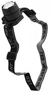
During our recent backpacking trip to Cane Creek State Park, one of the new toys we tested was a Timber Creek mini LED headlight. The Timber Creek mini LED headlight sells for about six dollars at the local Academy sports store. A bargain compared to the more expensive headlamps appearing on the gear lists of many Appalachian Trail through hikers. We suppose there is some cachet to sporting a twenty dollar Petzl LED headlight on the A.T., but we're not made of money and our family is fairly happy when we use our modest salary to purchase food and electricity.

So how does the little six dollar Timber Creek mini LED headlight perform? Fairly well. The LED headlight comes partially assembled with two button batteries and an elastic head band. The batteries are already installed, but one must remove a small piece of plastic which blocks the circuit. Also, one must thread the headband onto two small clips on either side of the LED headlight.

Once assembled, the LED headlight is very comfortable to wear. Its light weight and the elastic headband acts as a cushion against the forehead. No hard cold plastic, but rather a warm, soft cushion. The LED headlight is turned on and off by a push button along the rim of the headlight. Depending on the position of the LED holder when screwing back together, the button will be either at the top or the bottom. The button is encased in a rubber boot that provides a good degree of water resistance. The plastic case attached to the headband also includes a built in hinge so the LED headlamp can be tilted from forward to almost straight down. This was a very useful feature when sitting at a picnic table in the dark cooking.

We've since used the Timber Creek mini LED headlight on several backyard hammock camping shake downs. The LED headlight has never disappointed us. Due to its inexpensive cost, we plan to purchase several more for family members and to keep around the house for power outages.

TIP 1: When arriving in camp, put on your headlight and wear it around your neck as a necklace, Then, you'll know exactly where it is once darkness begins.

TIP 2: Wear your headlight around your neck when sleeping. Then, if a midnight cat hole calls, you can quickly find your light and take care of business.

Wednesday, April 28, 2010

Backpack Cover: Cabelas Blaze Orange

One of the items that comes up on most through hiker gear lists are backpack covers. As most of our backpacking trips have been under fair skies with only a handful of thunderstorms, we have largely backpacked sans cover for several decades. We have never needed a cover as we have been diligent regarding encasing everything dry in heavy duty trash bags sealed with doubled goose necks. Those few time that rain was heaped upon us, we simply pulled out an extra plastic bag and pulled it over the pack. Often, we have been the only person in a large group with a dry sleeping bag and clothes in the morning.

As we have never hiked in pouring rain and due to the abnormally cool wet weather this spring, there is a good possibility of our needing a backpack cover. Looking through the catalogs, there is no shortage of backpack covers. Prices usually ranged from twelve to twenty-five dollars depending on material and brand. Most are black or green. A few are bright blue. Only one backpack cover stood alone in blaze orange - Cabela's Blaze Orange Pack Rain Cover.

As we have long performed search and rescue on the ground and in the air, we are big believers in "see and be seen" in emergencies and to prevent emergencies. So, it was with some concern that we discovered that this year's section hike would take us through Pennsylvania state game lands during turkey hunting season. We have a lightweight mesh blaze orange vest that we wear on ground teams, but with a backpack covering much of our reverse, a blaze orange backpack cover seemed just the thing.

Our online order from Cabelas was swiftly delivered well before the estimated delivery date. The cover is well made from one large piece of blaze orange nylon. A cord with lock runs around the perimeter of the cover. The online reviews said this cover was large and large is an understatement. Its huge! While its an easy match for our large Camp Trails 5,000 inch pack, we were able to cinch it down to fit our smaller 3,100 inch Outdoor Products Arrowhead backpack. We were able to fold the cover into fourths and roll the cover into a small roll that easily fit into the undersized top pocket of our Arrowhead backpack.

We did note that when we put the cover over our backpack straps and waist belt ("the "wrong way") that we were able to cinch the cover down small enough that only the handle on our backpack was protruding. This should help protect our backpack straps while our backpack rides below on the Greyhound bus. The nylon seems too light for our pair of protruding poles, so we plan to hand carry our trekking poles onto the bus and store above or below our seat.

The Cabelas Blaze Orange backpack cover isn't for everyone, but if you want a large cover or a very visible cover, then this may be the backpack cover for you. For $15 plus another five for shipping, we consider a blaze orange backpack cover cheap insurance against not only rain, but flying wads of lead.

Friday, April 23, 2010

Trail Food: Freeze Dried Strawberries & Bananas

After lunch today we rummaged in our office food cache for something sweet for desert. Among the various little foil pouches from our recent grocery expedition was an individual sized pouch of Disney Freeze Dried Strawberries and Bananas. Remembering with fondness the freeze dried strawberries that we sometimes found among our MREs years ago, we decided sure, why not?

Ummm... Freeze dried strawberries. All the deliciousness without the sticky, staining juice. After crunching a few of the flat crisp strawberry sections, we opted for some banana. While the strawberries were our favorite, we do prefer freeze dried bananas to the hard dried banana chips that we have previously packed along the trail.

Unlike the freeze dried apples we reviewed earlier, we're a bit pressed to come up with ways to integrate the freeze dried strawberries and bananas into our meal plan. One thought is to open the bag up and separate the two fruits. Then, repackage the freeze dried bananas with some instant banana pudding mix and some Nido powdered milk for a more robust banana pudding. As for the strawberries, our only thought is to pack them along separately and later rehydrate them with water and sugar to form a chunky strawberry syrup to drizzle over a Twinkie for an improvised strawberry shortcake.

To summarize, we liked Disney Freeze Dried Strawberries and Bananas. We liked them so much we ate the entire bag in record time. We'll probably take a bag along on our section hike, but probably as ingredients in other entrees.

Disclosure: We select and purchase the product(s) reviewed. We have no material connection to either the manufacturer nor the retailer(s).

Thursday, April 22, 2010

Freezer Bag Cozies


If you read our earlier post on Disney Freeze Dried Real Sliced Apples, you know that we tested "cooking" our trail food breakfast in a freezer bag cozy. For those not familiar with freezer bag cooking, we're talking about putting a dehydrated meal into a quart freezer bag, adding hot water, waiting several minutes, and then nooshing right out of the plastic bag. No plates. No bowls. Just one small plastic bag with a messy inside that you deflate, zip close, and pack out to your home trash can. The one flaw in this system is that your hot water may cool down before your dried noodles or rice have had the opportunity to fully hydrate or soften. Thus, the cozy.

Making a homemade cozy

For our freezer bag cozy we selected a standard manila bubble padded envelope that a papperback book had arrived in. Ignoring the labels and the shipping tape, we trimmed the torn parts of the bag off and then trimmed one side of the bag to be about 2-3 inches shorter than the other. (Just remove a rectangle from one side at the opening end.) This provides a flap that can be folded over to trap the warmed air inside. We weren't sure how well an ordinary padded envelop would work. Would the plastic bubble wrap inside melt from the heat? Would the envelope distort causing our meal to suddenly pour out across our desk? Inquiring minds wanted to know.

Using a freezer bag cozy

Again, if you've read the freeze dried apples review, you already know we put a quart ziplock freezer bag into our modified envelope, dumped in two packets of oatmeal and a packet of apples, dumped in a cup of boiling hot water, zipped up the freezer bag and closed the flap on our "cozy". After a few minutes we opened everything up and give our oatmeal a short stir with a spoon. (Caution, do not use forks or knives inside your freezer bag. The heated plastic is extremely pliable and very easily punctured.) A few minutes later, we opened up the cozy and the freezer bag and dug in. HOT! Too hot!

Eating out of the bag while inside our cozy was a bit ackward. Taking the freezer bag out and putting the bag inside a small bowl proved more satisfactory. (Warning: do NOT take the hot freezer bag out of your cozy without having somewhere to put it. Its way too hot to hold in your hand.)

So, our hastily improvised bubble mailer cozy worked. The plastic bubbles did not melt, pop, or otherwise distort. The air withing the plastic bubble wrap provided extremely good insulation and kept our meal hot. We didn't need to line the bag with aluminum foil or anything.

As our cozy weighes next to nothing and packs very flat, we'll probably take it or an upgrade along on our section hike. While picking up some small plastic flip top bottles at The Container Store, we noted that they also carry Bubblope mailers, a bright foil version of our manilla mailer but with a velcro resealable flap. Bubblopes come in various colors of silver, gold, red, blue, and purple foil for just under $3. At that low price, we may shell out a few dollars for some trail bling.

UPDATE

We bought a $3 red Bubblope and used it on a two week Appalachian Trail section hike. The bubblope held up well and did not leak. There was some separation of the outside plastic from the envelope at the end of our hike. The bubblope was plenty deep and the velcro closure was extremely useful. Enjoyed some very hot oatmeal with apples and some wonderfully hot instant mashed potatoes.

Backpacking Fuel: Everclear Grain Alcohol

Now that we have made a couple of Super Cat alcohol stoves, our attention has turned to sources of fuel for said stoves. One form of alcohol mentioned as fuel is Everclear grain alcohol. Come to find out that Everclear grain alcohol comes in two versions: 190 proof and 150 proof. We did not know that as we seldom partake of hard liquor, just beer and wine mostly.

While stopping at a local liquor store to get a large Heinekin beer can for a homemade ultralight cooking system, we had inquired as to the availability of Everclear. We stopped by a second time to ascertain which version is sold in Arkansas. We get the full monty - 190 proof! A pint retails from four to six dollars depending on location. So, for local hikes, we have a source of stove fuel that we can also consume in a late night beverage, if desired. (By the way, Everclear grain alcohol has about 190 calories per ounce, so a nightcap does provide significant calories with zero fat or carbohydrates.)

While researching Everclear grain alcohol., we discovered that it is actually illigal to purchase in several states, including Virginia. This is cause for some concern as we had previously located a state liquor store Harpers Ferry, WV just west of the ATC Headquarters and a liquor store near Union Train station in DC. Both were possible sources for stove fuel. Now, we'll have to make some calls to check if Everclear grain alcohol is available, and if so, the proof, amount, and price. We'll post an update below once we know the details.

Wednesday, April 21, 2010

Trail Food: Disney Freeze Dried Real Sliced Apples

Today's trail food experiment was a "two fer." We combined two experiments into one. The trail food candidate was Disney Freeze Dried Real Sliced Apples that we found in the fruit section of our grocer. The freeze dried apples come in individual serving sized bags for about $1 ea. Each serving contains about one and a half apples for about 40-50 calories.

As we do for all taste tests, we opened the sealed bag and tasted the apples directly. Our first thought was "Oh, look! Little pieces of apple flavored foam." The bag was about a third full of little thin crisp wedges and looked as if a foam plate had been shattered. Fine. Not the most appealing look, so how do they taste? Munch, munch, munch... They taste vaguely familiar for those of us having dined on freeze dried peaches in meals rejected by Ethiopians (MREs). There was a bit of apple taste, but not overpowering.

We then proceeded with our "two fer" experiment. When we bought the freeze dried apples for trail food, we thought they would likely be good for supplementing the small bits of apple that come in our flavored oatmeal packets. So we added our remaining apple crisps to a quart freezer bag containing two packets of instant apple flavored oatmeal, one of our favorite trail foods of all time. We noted there seems to be more apple in the oatmeal packets than we remember. Nonetheless, we placed the quart bag in a bubble wrap padded envelope and added about a cup of hot water. (The padded envelope is the two in our two fer. More on that experiment later.) Minutes later we stirred everything; waited another minute or so; then chowed down. Yum! The now rehydrated apples were a welcome addition to the oatmeal. The meal seemed heartier and more satisfying both in taste and amount.

Disney Freeze Dried Apples makes our menu for the upcoming section hike, at least until the first resupply point. We plan to combine the freeze dried apples with two packets of Quaker apples and cinnamon oatmeal in a quart freeezer bag. That will be a major portion breakfast for the first five mornings, along with protein fortified hot chocolate and snack size fig newtons. So, our next trip to the same grocer in two weeks will include five bags of freeze dried real sliced apples.

Tuesday, April 20, 2010

Trail Food: Knorr Taco Rice

Another grocer, another load of trail food candidates. This trip netted us a good selection of "add hot water" products from Knorr, which we will be reviewing over the coming weeks.

Looking through our office larder we decided to go spicy and try Knorr Taco Rice. The package states that one bag contains two servings, so we poured out about half into a bowl and added the requisite amount of hot water. As we were using an uninsulated bowl, the liquid cooled down and was not completely absorbed by the rice. We took a few bites of the now al dente rice. It had a pleasing taste and after a full days hiking would probably have wolfed the rice down.

We then nuked the rice for 1-2 minutes in the office microwave. (Yes, I know there are no microwave ovens on the trail.) The additional heat caused the remaining water to be fully absorbed and the rice was soft and clumping. This time things tasted much better.

One blogger mentioned the Knorr rice products being too much to eat at one sitting, so he split the bags in half. He also added 1/4 cup of minute rice to each half and said that provided just the right amount to satisfy his hunger. So that will be out next experiment. Put the remaining serving in a freezer bag with 1/4 minute rice, add hot water, wait a bit, and eat. Watch for an update below.

By the way, we like Knorr Taco Rice and it made our menu for the upcoming section hike of the Appalachian Trail. Combined with the chipotle black bean dip and the vegetarian chili mix we reviewed earlier, we're thinking Mexican night along the trail somewhere. Hopefully, somewhere is near a can of cold beer.

Monday, April 19, 2010

Backpack Alcohol Stoves: Super Cat Homemade Stove

Making an ultralight backpack alcohol stove was one of the most fun things we've done this year. After researching alcohol stoves, we knew that this was the path if we wanted to backpack farther. We first thought we'd like to switch to Vargo's Triad XE, which offers the ability to use both alcohol and solid fuels. But, after considerable research and watching several YouTube videos, we decided on the Super Cat alcohol stove for our upcoming backpack trip. The Super Cat alcohol stove is the cheapest and simplest to build. While an alcohol stove, one can also use solid fuel tablets by first lining the stove with aluminum foil and then using a V-shaped wire grate to rest a pot, mug, or beer can.

The Super Cat alcohol stove starts with a 3oz cat food can, like Fancy Feast. For the catless, the same sized can is used for Armour potted meat.

After removing the lid and contents, the next step is to flatten the inside of the top lip of the can. We used a socket wrench extension and slowly rotated the can while flattening with a back and forth motion. You can use anything from plier handles to , as long as the object can take the exerted force. You're probably looking for something steel and round that you can easily grip.

Next, we marked off 16 points along the rim with a permanent marker. We started with 12 o-clock, then added 6. Then 3 and 9. Keep dividing segments in half until there are 16.

Third, we took an ordinary hand punch from the office supplies section of your local discount store and punched a hole about 1/4 inch below the marks on the rim. The holes punched easily. However, you will likely have to wiggle and jiggle to get the hole punch back out of the newly made hole. It won't spring free as with paper.

Once you've got a 3oz can with one row of 16 holes, you are now the proud owner of a Super Cat alcohol stove (simmering version).

To step up the simmering version of a Super Cat alcohol stove to a fast boiling version, simply add a second row of holes, offsetting them just below the first ring of holes. You should end up with a zig-zag pattern of holes.

Congratulations! You're done. Let's fire this baby up!

(Standard disclaimers: flammable fluid, metal container, ignition source, own risk)

We grabbed a steel sierra cup of water, a small piece of aluminum foil, and headed to the back yard. We put the foil down, set the Super Cat stove on top and squirted in some denatured alcohol. (We also could have used Everclear from the local liquor store at $4/pint. Denatured alcohol sells for $4-6 per quart.) We also squirted a wee bit of alcohol on the foil around the can and lit it with a mini Bic lighter. (One can also use a match and skip the alcohol around the can.

Be careful at this point as there is little, if any flame, with this stove. Always assume your alcohol stove is lit.

Give the stove about 20-30 seconds for the alcohol to start boiling before sliding your pot on. The flames should switch to the holes in the side of the can.

In a few minutes we had a cup of boiling hot water, ready for tea, cocoa, or soup.

The Super Cat alcohol stove was so simple and easy to make, that we made several and will probably make a half dozen more to build up a stockpile for friends and family. Know someone lugging propane bottle into backcountry? Make them a Super Cat stove and show them how to use it.

(If you liked this short article on the Super Cat alcohol stove, watch for the upcoming article on making a Heinekin cooking pot system. We're mid-build and awaiting a side-opening safety can opener.)

Thursday, April 15, 2010

Trail Food: Honey Peanut Butter

At lunch today we tried Justin's Organic Honey Peanut Butter, which we found at a nearby Whole Foods. Justin's Organic Honey Peanut Butter is available in individual sized foil packets for about sixty cents per packet. We're not a big fan of peanut butter, unless its mated with some Concord grape jam between two pieces of white bread and accompanied with a glass of cold milk. But, we are a fan of honey and have even kept bees a few years, so Honey Peanut Butter struck a sympathetic chord and we tossed a packet in our basket.

So, after lunching on some Armour potted meat, (we're after the 3oz. can to make a Super Cat alcohol stove, but that's a future post), we decided to sample Justin's Organic Honey Peanut Butter. The instructions say to knead the packet before opening. Hmmm... Just like the ubiquitous MRE's we once lunched on. They too had little foil packets of peanut butter, or cheese, to knead before consuming as there is sometimes some separation of the ingredients. Also, our experience has been the friction from kneading also warms the peanut butter and makes it easier to spread. Having a plastic knife available, we ignored the suggestion to oen just a corner and squeeze. We took a big swipe of creaminess and smeared the awaiting soda craker. Nice color and easy to spread.

We were a bit disappointed at our first bite as we didn't detect any sweetness nor a distinctive honey taste. The lack of sweetness was likely due to being organic, as most organic food products avoid the excessive sugar ladened into non-organic foods. To be fair we ate three crackers and finally said; "Enough!"

While we're not a fan, Justin's Organic Honey Peanut Butter might be a love connection for your taste buds. Its inexpensive, so buy a packet and give it a try.

Wednesday, April 14, 2010

Mobile Guide to the Appalachian Trail

We've been developing a new mobile web curriculum at the office. As part of our research, we discovered a cool mobile web design tool at Ubik.com. While playing with the tool to learn its capabilities, the idea struck us that we could create a small mobile web site to support our upcoming section hike. That idea led to the better idea to develop a lean digital guide book that could be easily viewed on mobile devices.

We are pleased to announce the Mobile Guide to the Appalachian Trail is under development. You can follow the build here:


As mobile devices are not currently standardized and most cannot handle large graphics, long pages, and javascript, we've decided on a simple menu for the new mobile guide:

As we're planning for a section hike of the AT in WV/MD/PA, we'll probably fill in the data for those sections of the mobile guide first. Then, we'll focus on the completing the emergency contact list for all states. Springer to Fontana section will follow third as new hikers will likely need the information most.

The purpose is not to supplant the existing ATC guide and data books, but to provide information in another format for fellow hikers. (Personally, I'd like to build the site and then hand everything over to the ATC for them to brand and possibly derive mobile ad income.)